Unaweep Tabeguache Scenic Byway
Dolores River
San Miguel River
Nucla Loop
Naturita
Uravan
Hanging Flume
Gateway
Bookcliffs
Palisades
Glenwood Springs
Frisco
As I experienced the past few frigid days and a minus 11degrees this morning in Frisco, Colorado, I am reminded of the last of my three day trip to the western border of Colorado and the eastern border of Utah, on Sunday October 17, 2010.
I woke up in Bedrock to a beautiful alpenglow on the butte above my camp site and went to read the information about the Dolores River http://bit.ly/elVyNB, that is only open for rafting for a short time in June. Apparently the historic Bedrock store at the end of the road I had gone down to the river was in the movie "Thelma and Louise."
We continued on Highway 80 to Vancorum. The road here was open range land and very straight with the river valley to the left and the Uncomapaghre Plateau in the distance.
In Vancorum we joined the Unaweep Tabeguache Scenic Byway http://bit.ly/fgwhpp by turning left and traveling north on Highway 141. I had taken this road going south on my way to raft the Grand Canyon in the fall of 2009, and this part of my trip was really the reason I had come west, as this road was so spectacular. I needed gas and some breakfast and so I turned off the road on the Nucla Loop but was a bit disturbed to find the name of the road was Calamity Road. I thought that the loop would bring us back to the Byway, but it actually starts north of Nucla and is a dirt 4X4 and mountain bike road up onto the Uncompaghre Plateau that comes out on the Byway way to the north. So I actually headed south to Naturita, a good sized town with the local highschool, a grocery store / gas station, some motels, and an airport. There were a lot of motorcycles parked at the motels. Highway 141 is a favorite fall drive for motorcyle enthusiasts.
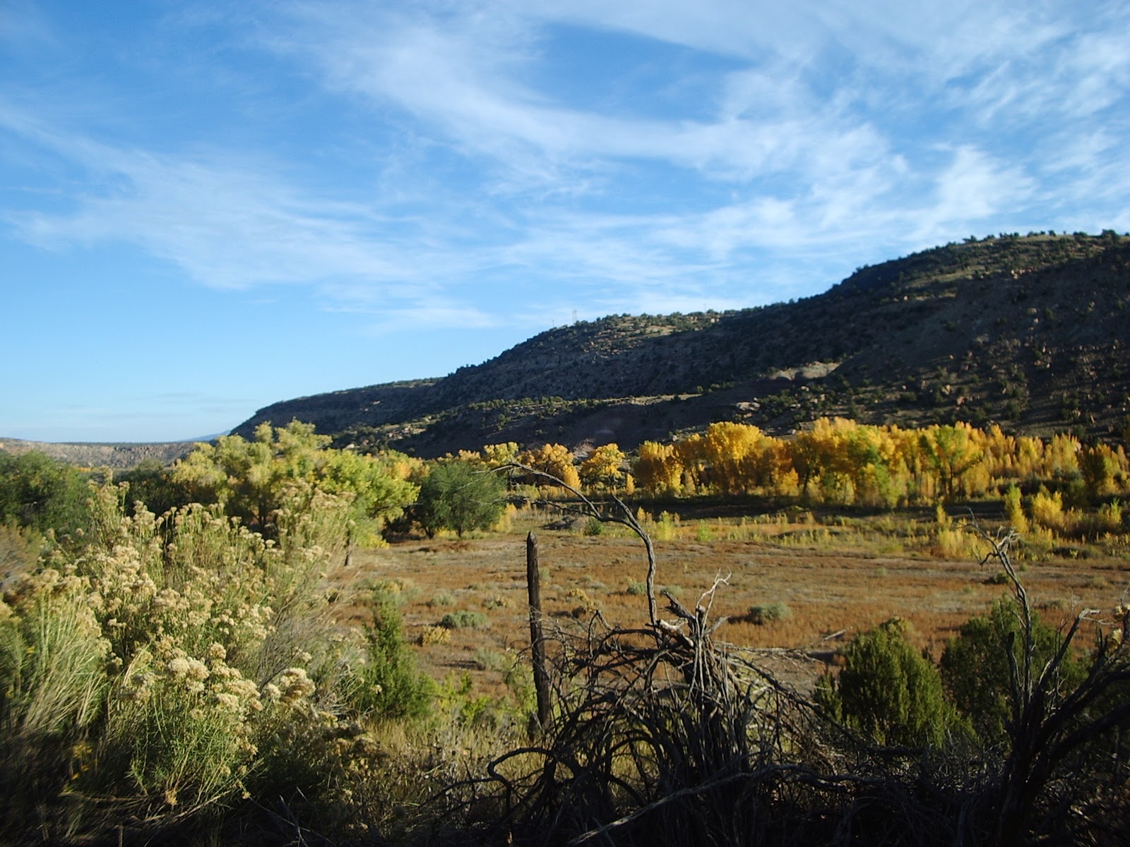
The road from Vancorum north follows the San Miguel River a tributary of the Dolores. The stands of Cottonwoods along the river were a brilliant yellow, with very large bushes of Rabbitbrush along the road side.
The first place of interest I came to is the ghost town of Uravan http://bit.ly/hSv9yX. This was the site of mining for Uranium and Vanadium (hence the name of the town) and the Vanadium Corporation of America, was founded in 1936. Both ores come from a yellow sedimentary rock called Carnolite. Uranium from the town was used during World War II for the Manhatten Project that lead to the development of the atomic bomb. Vanadium was used to harden steel - now Molybdenum is used and is also mined in Colorado at the Climax Mine on Freemont Pass in Park County and at the Henderson Mine in Summit County. At the height of the Cold War in the 1950s the town had over 200 mines. Uravan continued to thrive producing uranium for nuclear power plants until the 1980s. In 1986 the town became a superfund site and clean up continued until 2001. During the mining era the town produced 42 million pounds of Uranium and 220 million pounds of Vanadium. All that remains now is is a turn off and interpretive sign at mile marker 76.
I crossed over the San Miguel river and as it enters a deep canyon the road climbs onto the plateau above with plenty of Pinon Juniper and Sage Brush with the mountain sides dotted with mine tailings. At mile marker 81 is the Hanging Flume overlook and interpretive sign http://bit.ly/dPSN71. This area was discovered in 1776 when two Spanish friars, Francisco Atanasio Dominguez and Silverstre Valez de Escalante set out from Santa Fe to find a route to California. The Dominguez-Escalante Expedition covered 2000 miles in the states of New Mexico, Colorado, Utah and Arizona. In the late 1800s the Montrose Placer Mining Company needed water for their gold mining claims and decided to build a flume http://bit.ly/frpduU to transport the water needed for their placer mines http://bit.ly/hrbdvB. This flume would have to be ten miles long, and to complete the entire route at the proper gradient, the flume would have to cling to seven miles of sheer rock walls, at times suspended hundreds of feet above the river. The Hanging Flume is gradually being restored and was designated as a World Heritage Site in 2006. It is one of the World Monument Fund's 100 most endangered sites, along with such notable destinations as the Great Wall of China, Ellis Island and Mesa Verde.

Between mile markers 88 and 89 the San Miguel joins the Dolores River and the road enters the Dolores River Canyon that lasts until mile marker 100 with truly spectacular scenery.

Once the canyon widens out there are many beautiful farms including one for reindeer. At the town of Gateway where the road crosses the Dolores and it turns to the west to begin its journey to meet the Colorado River in Utah, there is the stunning Gateway Canyons Resort http://bit.ly/hL4tHP. This is the junction of the Dolores River Canyon and the Unaweep Canyon and the road turns to the northeast.
At mile marker 117 is the West Creek Picnic Area where I enjoyed lunch and Sawyer had a dip in West Creek.

Beginning at mile marker 121 is for me the most beautiful part of the trip. On the right hand side of the road is the northern edge of the Uncompaghre Plateau. Its slopes are a kaleidoscope of hues from the Scrub Oaks, Sage Brush, and Rabbit Bruish - pale yellow, green, brown, bronze and ruby red with splashes of bright yellow in the gullies from the Aspen trees. At mile marker 125 the Gateway Canyons Resort has their stables. The rest of the valley is filled with farms until mile marker 135. Unfortunately the valley is really wide and it was hard to obtain a good picture of the colors on the slopes but hopefully these pictures give an idea of the valley and the incredible vegetation along the roadside.


At mile marker 140 the Nucla Loop rejoins the highway winding down from the plateau. After the canyon the road climbs and at mile marker 147 there is a great view of the Bookcliffs to the north of Grand Junction and the Colorado River. The road finishes at mile marker 151 and joins Highway 50 and then I turned off on Highway 141 to Palisades. On Highway 6 in Palisades where I stopped to try and buy peaches but the produce was into the fall season with apples, pumpkins, chile peppers and gourds. As I crossed the Colorado River I had now finished my loop and would retrace my route on Interstate 70 back to Frisco, Colorado. As I passed Glenwood Springs I was able to catch a wonderful snowcapped view of Mount Sopris. Driving next to the Colorado River with the engineering marvel of the elevated part of Glenwood Canyon signified the end of my Fall and winter's approach and hopfully a great ski season for High Country Activities.


0 comments:
Post a Comment